Using Scout with the Dronetag App
Using Scout with Dronetag App is only possible when Scout is used in Cloud Mode.
This guide walks you through using your Dronetag Scout device with the Dronetag app.
The application requires version v2.126.1 or higher.
The Dronetag App is available on multiple platforms, offering a seamless experience whether you use it on the web or on your mobile or tablet device. While the web version might be the most comfortable for some tasks, all features are fully accessible on mobile and tablets as well.
Registering Your Scout
Before getting started, make sure you have a Dronetag account. You can sign up for free at dronetag.app.
To view your Scout’s data in the app, you’ll need to register the device to your account. Follow these steps:
- Navigate to the My Devices page.
- Click the Register new button in the top-right corner.
- Enter your Scout’s serial number.
Some Scout kits come pre-registered to preconfigured accounts. If that’s your case, you already get your log-in name and password from us. You may skip this step.
To verify if your device is already registered, head to the My Devices page and check if your Scout appears on the list.
Setting Your Data Privacy
Before you start using the app, take a moment to review your data visibility settings.
Go to your profile page and click on Cloud Data Visibility. This setting determines whether your drone data is visible to the public or kept private.
This setting affects all devices associated with your account. If a device is moved to a different account, it will follow that account’s visibility settings.
Checking the Status of Your Scout
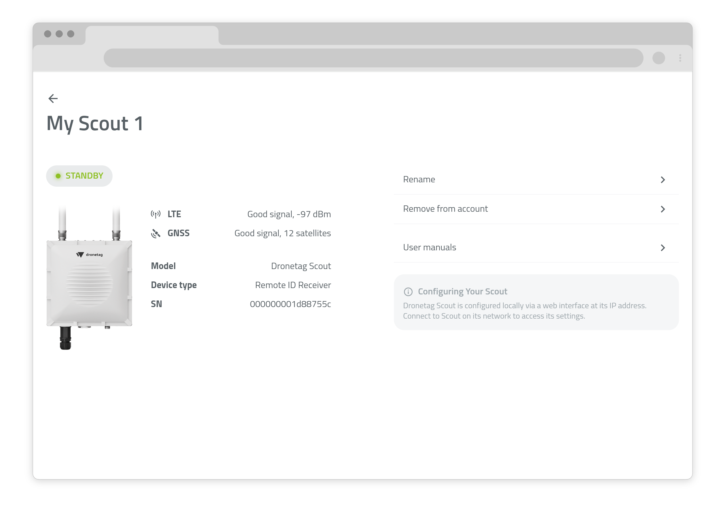
To check the status of your Scout in real-time.
- Navigate to the My Devices page.
- Select the device you want to check.
On this screen, you will be able to see a basic overview of its status, including:
- Online/offline status
- LTE - signal strength (if installed)
- GNSS - number of satellites
Device configuration is not available in the app. To change settings, you need to connect to the Scout web interface. Learn more about Scout configuration here.
Viewing Detections in Real-Time
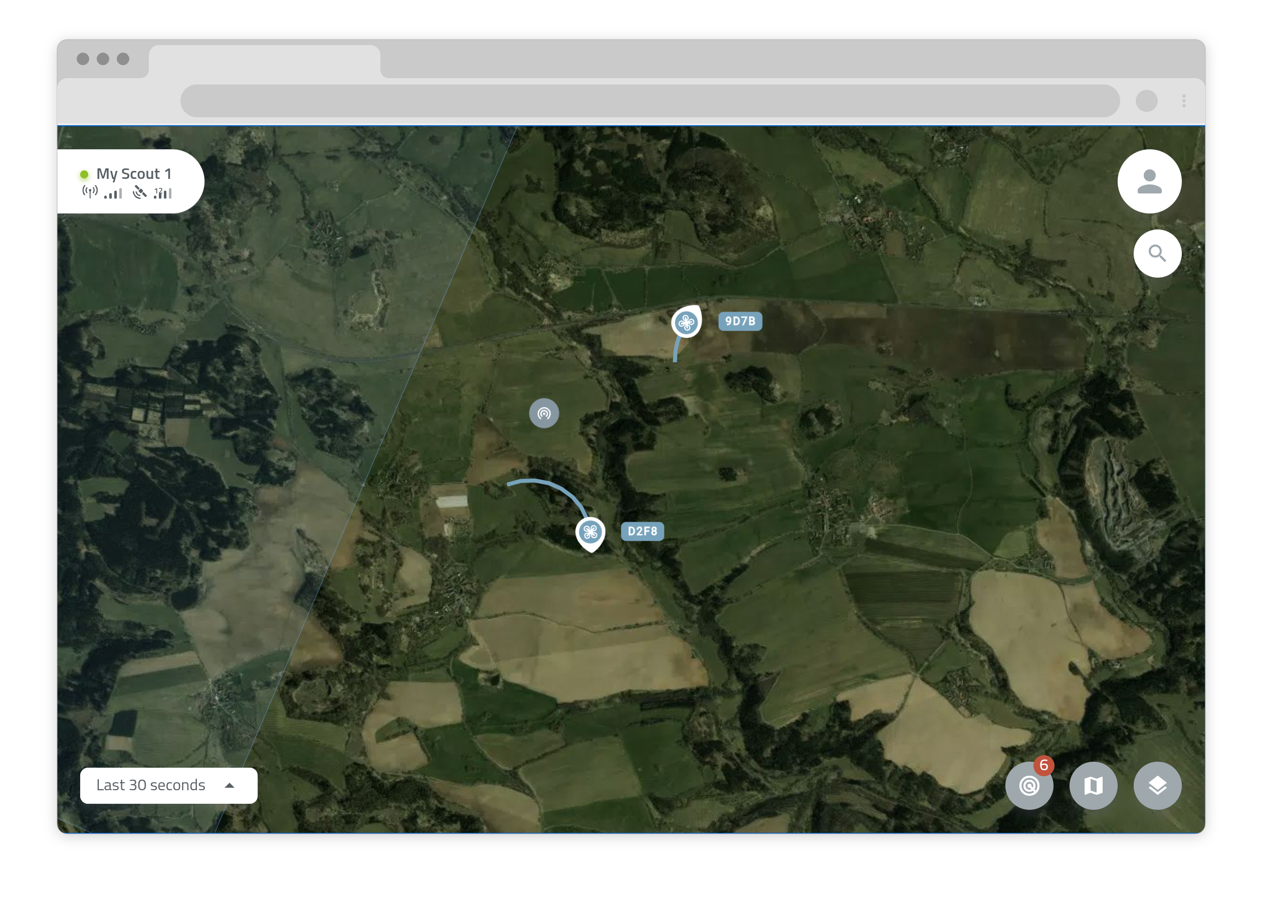
From the app’s main map screen, you can see all drone traffic accessible to your account — including your own Scout and public drones from other users.
Click on icons in the map to view detailed information such as drone position, altitude, and speed.
Map Icon Legend
UAV Location — Indicates the current position of a drone.
Operator Location — Shows the position of the drone operator, when available.
Receiver Location — Displays the location of a Remote ID receiver.
Browsing Detection History
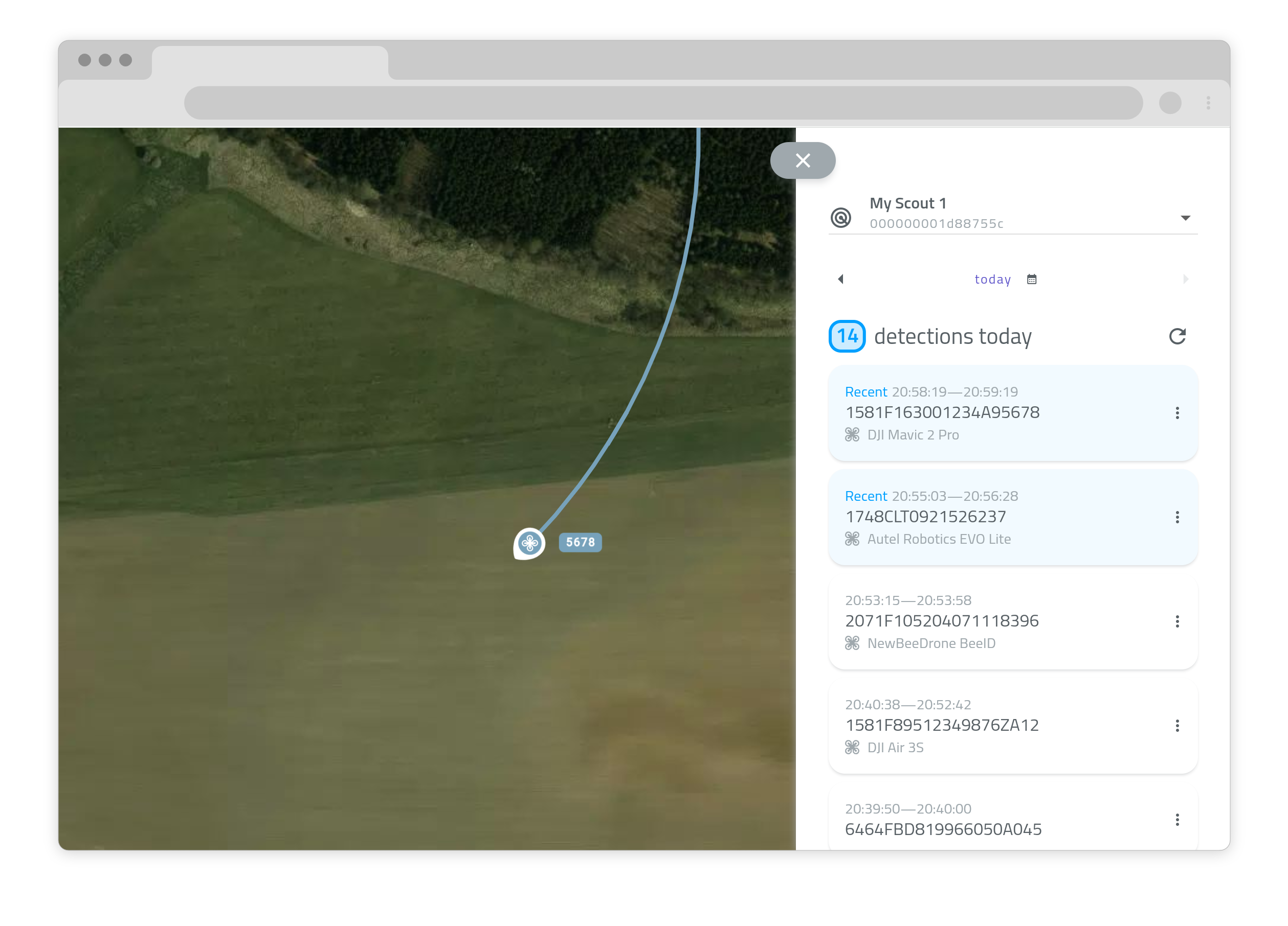
To view past detections:
- Tap the radar icon at the bottom of the map screen, or
- Go to your profile page and select My Detections.
This opens a list of all detections available to you.
Use the dropdown menu at the top to select a specific device (if you have more than one). Then choose the desired date — by default, it shows the current day.
We're improving this section with advanced filtering, sorting, and search tools to make it easier to navigate your detection history.
Viewing Detection Details
You can open detailed views for each detection. What happens next depends on the age of the detection:
- Live or recent detections: The map will automatically scroll to the detection's current position.
- Older detections: You’ll be taken to a dedicated detail page showing all the information captured.
Tap the three-dot menu on the right for additional options.
Exporting Detection History
You can export detection data and view it using mapping tools like Google Earth, QGIS, Mapbox, or OpenStreetMap (OSM).
To export:
- Open a detection detail screen in the app.
- Tap Export in the top-right corner and select the KML format.
Here’s how to open it in Google Earth:
- Visit Google Earth Web.
- Create a new project.
- Go to File → Open local KML file and select your exported file.
Using the Dronetag App on Mobile
The Dronetag App is fully cross-platform — meaning you can access all features from your mobile device just as you would on the web.
Our app is available for both iOS and Android, allowing you to use it on your smartphone or tablet. You can download it from the App Store or Google Play.
All web app features — including device registration, real-time tracking, and detection history — are also available in the mobile app.